It's my birthday! Yep, another year older.
I'll return to the photos from Kenya in my next post, but to mark this occasion I would like to look back and show you some of my favourite photos from before 2003 - these are some of the shots that made me realise how much I enjoyed photography.
So, here they are, in no particular order apart from how I discovered them while browsing my collection. As always, click a photo for a larger version.August 1997, Gloucestershire, UK
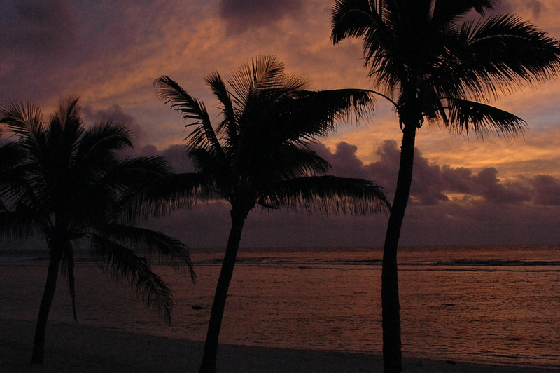
The best sunset shot I've ever taken.
I think everyone has a favourite sunset photo, because everyone takes photos of nice sunsets and they are relatively hard to mess up if you leave the camera to itself. However, this picture reflects the sky that evening exactly - it amazed me then and it amazes me every time I look at the photo now, and, although I've lost touch with them since, I wonder if the people with me there remember it too.
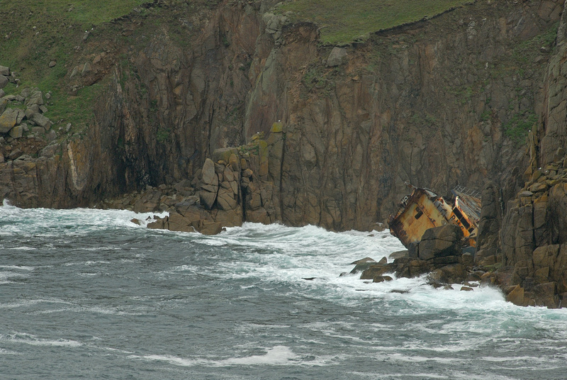
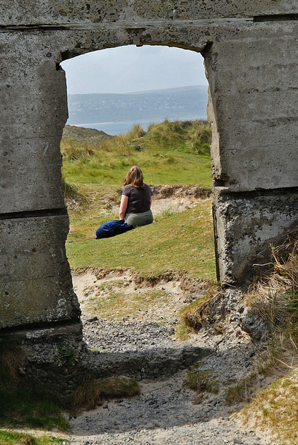
2001, Zakynthos, Greece
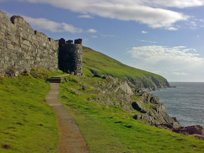
Smugglers Cove.
This shot, taken from a viewpoint on the cliff-top, shows the ship that washed up on the beach in 1980.
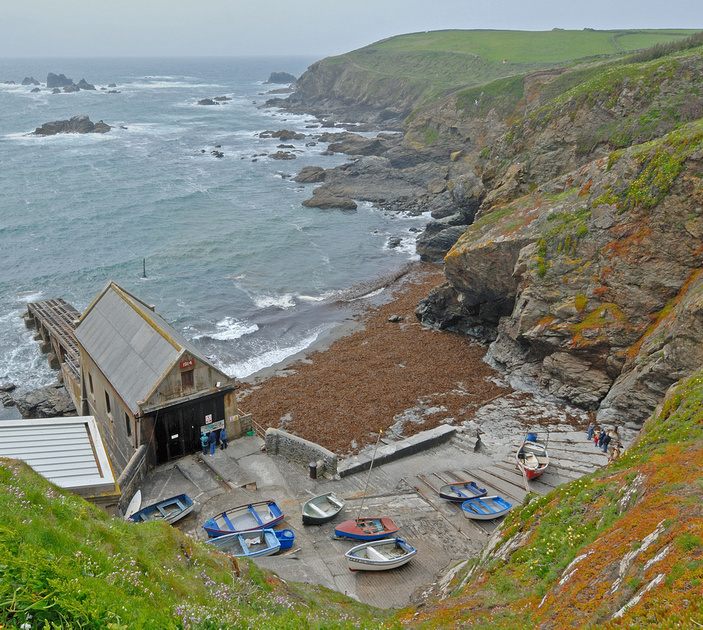
The real name of this beach is Navagio, but it is called Sugglers Cove by many as the ship, the MV Panagiotis, was allegedly carrying cigarettes illegally between Turkey and Italy. August 1999, Cornwall, UK
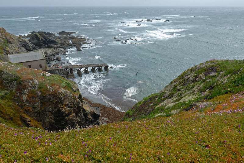
A view over Land's End.
This shot was taken looking directly down over the edge of England's most westerly point.
I've been back since, and never been allowed to get anywhere near this close to the cliff.
Late 1997, Norfolk, UK
Wells-Next-the-Sea
It's not perfect (the prints are unevenly spaced and broken by another set in the mid-distance) but I always liked this one. I don't remember it being particularly early in the day, but the time of year meant the beach wasn't used much.
The scanning process has also added quite a lot of vignetting to the bottom of the photo - I don't think it was there in the original, but it adds to the atmosphere of the shot.
2002, Austria
The view from Zwölferkogel
During a walking holiday staying in Saalbach-Hinterglemm we attempted and achieved the top of Zwölferkogel.
The view on a clear day such as this is amazing - overlooking Hinterglemm, Wiesenegg and finally Saalbach where we started the journey.
Spring 1997, British Columbia
Bridal Veil Falls Provincial Park
This park is a couple of hours east of Vancouver. Park up and walk along forest paths to get to the falls themselves.
Even though this photo is so simple it has always been amongst my favourites - the way it splits the scene into three both vertically and horizontally just appealed for some reason. This was taken long before I knew about the rule of thirds, but now I do I can see why the photo is successful. In case you're wondering why I picked 2003 - this was when I got my first digital camera, so all my photos from before then have to be scanned in before I can upload them, so it seemed a good cut-off point.
The photos from before 2001 were taken with a simple point-and-shoot zoom camera, which goes to show you don't need to spend thousands on equipment.
I hope you enjoyed me wondering through the past for a while.